
File:Andreanof Map.jpg
此为最大尺寸。
Andreanof_Map.jpg (560 × 249像素,文件大小:24 KB,MIME类型:image/jpeg)
摘要
| 描述 |
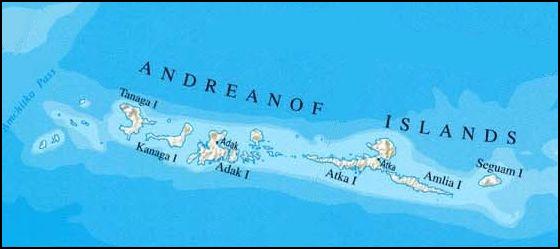
Deutsch: Karte der Andreanof Islands, Alaska |
| 日期 | |
| 来源 | http://www.lib.utexas.edu/maps/united_states/united_states_wall_2002_ak.jpg, cropepd |
| 作者 | nationalatlas.gov/U.S. Geological Survey, edited by Ulrich Kaden |
许可协议
|
|
文件历史
点击某个日期/时间查看对应时刻的文件。
| 日期/时间 | 缩略图 | 大小 | 用户 | 备注 | |
|---|---|---|---|---|---|
| 当前 | 2009年2月13日 (五) 15:37 | | 560 × 249(24 KB) | Ulrich Kaden | {{Information |Description={{en|1=Map of the Andreanof Islands}} {{de|1=Karte der Andreanof Islands}} |Source=http://www.lib.utexas.edu/maps/united_states/united_states_wall_2002_ak.jpg |Author=University of Texas / Own Work |Date=2009 |Permission= |other |
文件用途
以下页面使用本文件:
全域文件用途
以下其他wiki使用此文件:
- ar.wikipedia.org上的用途
- ast.wikipedia.org上的用途
- ca.wikipedia.org上的用途
- de.wikipedia.org上的用途
- el.wikipedia.org上的用途
- en.wikipedia.org上的用途
- es.wikipedia.org上的用途
- fi.wikipedia.org上的用途
- gl.wikipedia.org上的用途
- incubator.wikimedia.org上的用途
- it.wikipedia.org上的用途
- ka.wikipedia.org上的用途
- ko.wikipedia.org上的用途
- no.wikipedia.org上的用途
- www.wikidata.org上的用途